HOME > Environment > Geology & Geography
Geology & Geography
The BFS, like all of “flatland” Claremont, lies on the great alluvial fan of San Antonio Creek. This fan has its narrow northern end in the mouth of San Antonio Canyon, and widens greatly as it approaches the Santa Ana River some 15 miles to the south. The material of the fan is erosional debris of various sizes, washed out of the mountains during occasional heavy rains and floods, and deposited by the Creek as it loses momentum upon leaving the mountains. The geology and geological history of the alluvium in Claremont is intimately tied to past and present geological activities in the San Gabriel Mountains.
Claremont lies somewhat west of the mouth of San Antonio Canyon, and the alluvial fan here slopes both to the south and to the west, at an angle of somewhat under 2°. The slope is much steeper at the canyon mouth — over 3° at the top of the fan — and gradually declines to less than 1° slope by the time it reaches the Santa Ana River. Away from the mountain front, the San Antonio fan joins with fans from other streams of the south mountain front forming a broad compound fan called a bajada, across which these streams flow to their confluence with the Santa Ana. In most years the only surface flow in these streams below the mountains is during and shortly after the rainy season. Before most of these streams were confined to concrete ditches, they meandered over the surface of their fans, changing course from one temporary channel to another as debris was deposited or moved around. Channelization of these streams not only has reduced erosional deposition during floods, it seems to have resulted in the extinction of an unusual fresh-water shrimp, Syncaris pasadenae. The original locality for this shrimp was where the Rose Bowl now stands and the last record for the San Antonio drainage seems to be 1920. The last time the species was collected anywhere was 1933, from a since channelized stream near San Bernardino.
To see what the alluvium at the BFS looks like, you can examine the channel cut by the seasonal stream just south of the Lowell Avenue gate. You will see pebbles, cobbles, and boulders embedded in fine gravels and sand, the whole vertical section showing crude but unmistakable layering, or stratification. All the surfaces of these hard rocks are rounded, evidence for stream abrasion. You can see this better at the gravel pit where it is clear that the layers are parallel with the ground surface, dipping at slightly less than 2° to the SW. Note also that the layers are not continuous, but are actually lens-shaped. Redder-colored, more weathered layers are visible towards the bottom of the gravel pit walls.
We interpret these weathered layers as older than the grayer colored surface layers, and conclude that all the visible gravels were washed down from the mountains, that the whole “flatland” region is underlain by gravel and sand, and that the top of each deeper layer is a buried former land surface. We also conclude that all these layers are the product of a continuing depositional process based on continuing erosion from the San Gabriels. In fact, the uppermost layer was deposited by the March 1938 floods, before San Antonio Dam was built in 1951.
What is underneath the alluvium? If you look at some of the road cuts above San Antonio Dam you will see the same type of layered alluvium, very reddish and weathered and so older than the surface layers on the valley floor. In places you can see that these layers lie on solid rock, bedrock or basement. Basement rocks compose the largest part of the San Gabriel Mountain mass, and include both granite (igneous rocks that cooled well beneath the surface) and gneiss (rock that has been metamorphically transformed by intense pressure and heat). These basement rocks in the mountains are the parent material for the alluvial debris in the fans of the valley. Nowhere on these fans is the basement complex exposed. However, wells drilled into this alluvium (to tap ground water carried in these permeable gravels) have sometimes penetrated all the way through to bedrock. In northern Claremont, basement rocks are found from 300 to 800 feet below the present surface. South of Foothill Blvd. wells drilled as deep as 1100 feet have not encountered bedrock. In those places where bedrock has been contacted by drilling, it is not at a uniform distance from the surface. Geologists conclude that the original ground surface upon which the alluvium began to be deposited hundreds of thousands of years ago was not flat, but rather a surface of some topographic relief, including hills and valleys and stream courses. Deposition of alluvial debris occurred most rapidly during the much wetter Pleistocene Epoch (the Ice Age, ending about 10,000 years ago), but continues today: the alluvial fans are still getting thicker.
Just north of Foothill Blvd. but south of the Indian Hill mesa, the bedrock slopes very steeply downward to the south. This is interpreted as the result of as much as 600 feet of vertical displacement along a geological fault which runs roughly parallel to and just north of Foothill Blvd., called the Indian Hill Fault. Other faults in the valleys, all parallel or sub-parallel to the mountain fronts, can be inferred from the depths in different wells to bedrock or to ground water (the water table, the upper surface of the zone where water fully saturates the pore spaces between the gravel particles). In our area, the only other inferred fault is the San Jose Fault which runs in a northeasterly direction from near the Los Angeles County Fairgrounds, cutting across the southeast corner of the Pomona College campus as it aims towards the eastern side of the mouth of San Antonio Canyon.
You might think that the great depth of alluvial fill in the valley would have required the levelling of the mountains by erosion. But not only do the San Gabriels still stand, they are getting higher: in the San Fernando Earthquake of 9 February 1970, the San Gabriels rose a total of 7 feet relative to the San Fernando Valley Floor and also moved about a foot southwesterly. That the San Gabriels are a very young mountain range is abundantly evident from the steep and inaccessible nature of the topography. The streams, including San Antonio Creek, have very narrowly V-shaped canyons with a very steep gradient. In appears that the San Gabriels are being uplifted as a result of north-south compressive forces associated with the San Andreas Fault system, which forms the northern boundary of the mountains. Uplift is estimated to be 4000-5000 feet in the Claremont area, and is believed to have begun as recently as the early Pleistocene. Uplift has not been continuous: side terraces in several canyons testify to the presence of quiet times when erosional processes dominated over uplift. These terraces are particularly evident in Cucamonga Canyon.
The south face of the San Gabriels is very steep, with a sharp boundary between the basement rocks of the mountain mass and the alluvium of the valley floor. This boundary is the general location of the frontal fault system called the Sierra Madre-Cucamonga Fault, north of which the mountains are being uplifted relative to the valley. When the mountains are uplifted by an earthquake such as the San Fernando Quake of 1970, the alluvial fans are often broken at their heads by small scarps; the maximum size of such scarps in the San Fernando Quake was about 2 feet. You can see that it would take many quakes, presumably including some of much greater magnitude than the San Fernando Quake, to cause the great elevational differences between mountain tops (Mt. Baldy is 10,080 feet) and the valley floor basement rocks, most of which are below sea level.
After each uplift, the streams will continue to erode, and the upper parts of some fans may be isolated from further direct stream erosion. Remnants of such older alluvial surfaces are visible in the Claremont area, most notably Indian Hill mesa itself, formed of much- weathered reddish alluvium termed the San Dimas Formation. Indian Hill mesa is elongated parallel to the radius of the San Antonio fan, with a maximum slope of 1°23' away from its apex. This is enough less than the 1°55' slope of the surrounding Recent fan that, while the mesa is only 15 feet high at its northeast end, it rises to 40 feet above the present alluvium at its southwest end. Other outcrops of San Dimas alluvium are exposed further south in Claremont, but are not so elevated. This older San Dimas alluvium is also visible at the mouth of San Antonio Canyon, and as benches and mesas to the east. Its age has been estimated as Pleistocene because of the discovery of fossils of the Imperial Mammoth (Elephas imperator) in this formation in San Dimas. Indian Hill mesa is thus a remnant of the extensive Pleistocene alluvial surface of San Antonio Creek, isolated by recent uplift.
To the east, at the tops of Cucamonga, Deer, and Day Creek alluvial fans, there are conspicuous fault scarps, varying from as low as 10 feet to higher than 100 feet, formed along the Cucamonga Fault. There are no known earthquakes during historic times (200 years) which can unequivocally be attributed to the Cucamonga Fault in this area, but on a geological time scale these scarps are very recent in origin, as shown by their uneroded surfaces. The Sierra Madre-Cucamonga Fault must be regarded as an active fault. Scarps are much less visible at the top of the San Antonio Fan, though it is possible that the slope on which Claraboya was developed is an old fault scarp.
The San Antonio alluvial fan, like the other fans and bajadas of the Los Angeles Basin, is able to hold a large volume of ground water, derived from snowmelt and rainfall in the mountains, which is mined (pumped) for domestic and agricultural use. Before pumping began to lower the water table (meaning that pumping extractions exceed replenishment, that is, the ground water is in overdraft), some of the water-bearing layers (aquifers) actually brought water to the surface as artesian flow. Called cienegas by the Spanish, these areas supported startlingly lush growths of bulrush (Scirpus), cattail (Typha) and other aquatic vegetation, and served as breeding areas for local amphibians and other aquatic and semi-aquatic animals. Once such a cienega was located where Pilgrim Place is now. After the 1969 rains, artesian water flowed along Sixth and Berkeley for several months. Other local cienegas included one at the present site of Wig Beach and several north of Foothill Blvd. The only surface water flow after the 1978 rains was north of Foothill and east of Padua Ave.
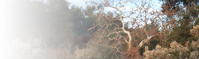
In a few places on the alluvial fan, sub-surface ground water flows may still be close enough to the surface to support deep-rooted trees. This may be the reason for the presence of Quercus and Platanus trees at the BFS, for there is no evidence for permanent surface water in this area. Elsewhere on the fan, with the water table too deep for root penetration, the highly permeable surface deposits and soils are capable of supporting only the typical Coastal Sage Scrub Community, so well adapted to summer drought and winter rains.
© 2001-2015 Bernard Field Station Faculty Advisory Committee
Page last updated 6 September 2012 by Nancy Hamlett.